
The rains had cleared and left a lovely rainbow. The Bowen Island Everything Else Facebook page was buzzing with everyone's photos of the rainbow. :D Here's mine! Clearly, there had been far too much snow and rain lately, for the rainbow to garner so much excitement.

Feeling like I could do anything, I headed over to Artisan Square to grab breakfast at Artisan Eats, and stopped by Bell'occio, where the owner Sharon announced that she had finished making the little felted replica of Rory!


I thought it was pretty cute. Rory was less impressed. lol.


I decided that this would be the day to tackle part of Mt Gardner, Bowen Island's most famous peak. At 719m, it is a challenging climb for even the most active hikers. I decided I wouldn't go to the peak on this day, but rather dip my toe in with a shorter, easier hike up one side. (I'd hit the two peaks on a later walk.)

I decided to head up Hiker's Trail and come down Skid Trail. It would be a nice 2.7 km loop from the North Access trailhead along Mt Gardner Rd, and would rise up about 211 m in elevation from the trailhead.

(this is a screenshot from the PDF map at bowentrails.ca)
Next, rather than drive to the trailhead -- which is totally doable and has a nice little parking lot-- I thought I'd walk over to the trailhead from the ferry. That would add on another 3.5 km of mostly flat (60-80 m of elevation change) in each direction, for a total hike of about 9.5 km and 270-290m in elevation.

(click on map to enlarge)
Compared to yesterday's hike on Mt Collins, the trails through Crippen park and on Mt Gardner were extremely well-marked! I never once got lost or even worried about it. The Rotary Club printed and online map is also pretty easy to follow, although one can even use google maps, if one zooms in close enough!
But I'm getting ahead of myself. My journey began near the ferry terminal. I followed Bowen Island Trunk Rd (aka "Government Rd") uphill a few metres until I saw a sign for Crippen Regional Park. It pointed me to a trail entrance.

The trail led fairly directly to the Memorial Garden. I spent some time exploring it on a previous visit, but this time, I turned left at the gate and forged onward along Alder Grove Trail.


Someone had built a stone circle beneath a giant cedar tree.


I got a glimpse of the Lagoon on my way past.

I kept following Alder Grove Trail, past Bridal Veil Falls, and out to Miller Rd. This time, I didn't go in to visit the falls either, but I caught a glimpse of them through the trees as I passed.

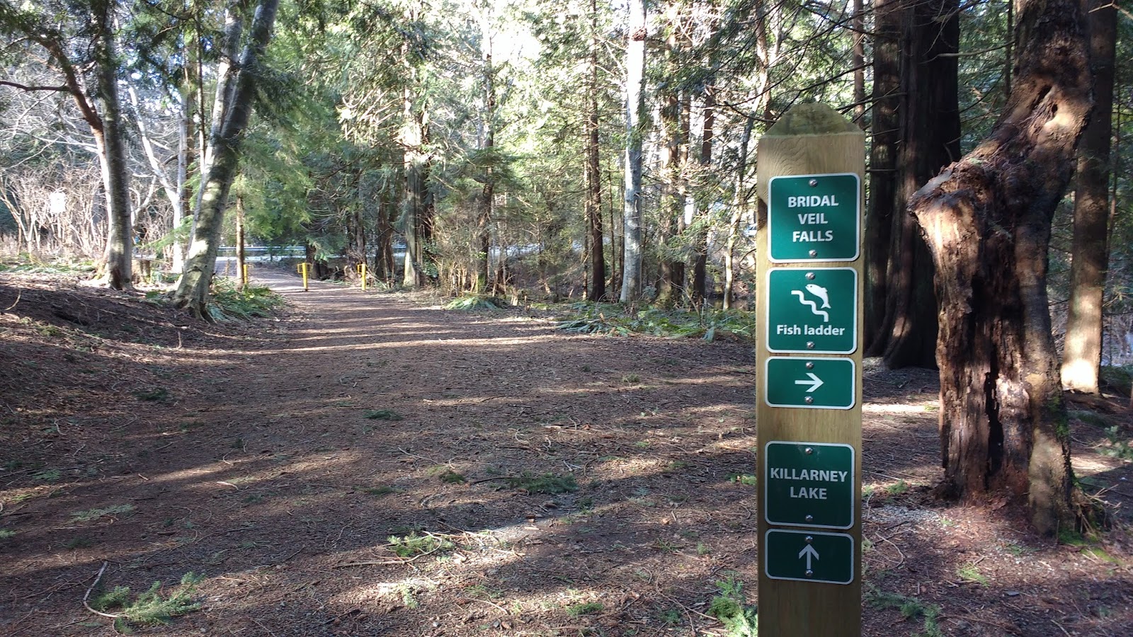
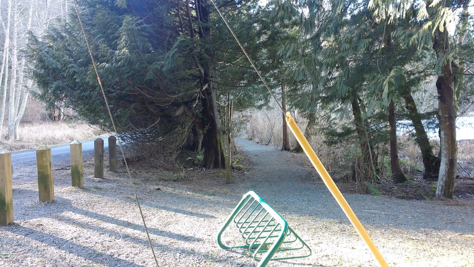
At Miller Rd, there was a crosswalk and a way to continue straight into the park on the other side of the road; however, on this day, I turned right and followed the road for about 140 m until I saw another entrance to Crippen Park, this one replete with a little parking lot.


I took Killarney Creek Trail, which made a 420 m bee-line straight towards Killarney Lake.


Where the trail split into two, I stayed on Killarney Creek Trail, on the left.


I turned left where the trail met Magee Rd. Magee Rd is really just a single lane gravel road. A yellow sign announces that walkers should take care on this "busy road," but there are not often any cars at all. Hence my surprise when one puttered past just as I approached!

Maybe 50 m later, I turned in towards Killarney Lake. The path led past the small dam to the shore of the lake.


Not a soul sat at the picnic tables, nestled beneath the trees. I took a moment to capture a photo of the clouds reflected in the perfectly still water.


There was still some ice on the surface of the lake, but days of skating on it were long over.
I could have cut through to the road here, but I thought it would be nicer to follow the path around the contour of the lake.

A little later, there was another opportunity to join the road, but I stayed on the path until I got to the little wooden bridge and the gravel "beach" with the 360° panoramic view of the lake.


Just past that, a trail led up the hill to the left, and a sign on the lake-side of the trail pointed me up towards Mt Gardner.


The trail was steep and narrow, but it soon leveled out as it passed a giant gravel pile and arrived at Mt Gardner Rd.


After passing the two yellow posts, I turned right and followed Mt Gardner Rd about 210 m to the intersection with Bowen Pit Rd (aka Hiker's Trail Rd).


The information kiosk was easily visible at the intersection. However, the map itself was barely legible: yellow trails on a green background! Whose idea was that?? I managed to locate the trails I intended to take, and noted a "viewpoint" icon on the route (which I never did see, along the way).


A sign beside the map noted the trail difficulty: double black diamond. It described a 10.5 km trail run "for experienced trail runners only!" that would lead up and past the North Summit, along a route marked with large orange circles. It also advised to tell someone of your plans, and warned: "If you crash, you won't be found for hours."

Well, luckily for me, I did tell someone where I would be, and I wasn't planning on such a challenging route, on my first time up! ;)
As I headed up the gravel road from the trailhead kiosk, a Stong's grocery delivery van passed me. It gave me a start... I didn't realize that there were houses up here! The van turned right at the first intersection, and headed down towards some houses.

The road was fairly steep, right from the get-go. Perhaps that's why someone had posted a sign quoting the Dao De Jing: "A journey of a thousand miles begins with a single step."

I passed some large stumps with notches cut into them. Remnants of springboard logging that was done in the area around 1900. Despite this, the mountain still has some old growth stands of Douglas Fir. None, however, are anywhere near as old as Opa. Instead of 1000 years, they are closer to a "mere" 200 years old.

Reaching the gate marking the trailhead, I checked my GPS. My phone had no signal. I gulped in alarm. I had not expected that I would not have GPS on this hike! I stopped a guy on a bike to double-check that I was in the right place and where that corresponded to on the map. He was pretty sure we were at the trailhead, but he had never hiked here before either.

While he chained his bike to a tree and prepared to head up, I noticed that to the right of this area was marked as the David Otter Nature Reserve. Some new trees had recently been planted, and protected by wire mesh. They looked very similar to the ones Colin and I had seen on Mt Apodaca.

Mt Gardner had known its share of logging and mining, including the Bonanza Mines in the early 1900s, which saw attempts at revival in the late 1980s and early 2000s. Bowen Islanders were concerned that these types of uses could be revived again in the future, and sought ways to protect the natural landscape.
One of these initiatives was to have Mt Gardner designated as a "Recreation Site" under Section 56 of the Forest and Range Act. This would mean that all non-recreational use would be prohibited. Part of the agreement stipulates that "the community will provide routine observation and maintenance of the trails."
Another initiative was to extend even more protection to the privately-donated areas of the David Otter Reserve, a 7.4 acre riparian area that acts as "nature corridor" connecting the Regional Crippen Park and the Provincial Crown Lands of Mt Gardner. Since "human use of the reserve, even light walking, could destroy the ecosystems this reserve was created to protect. Therefore, we ask visitors to refrain from venturing into this nature reserve and instead use nearby Crippen Park for walking and nature appreciation." The goal of the Municipality is to leave these lands untouched, save for annual monitoring by the Island Trust and the Warden.
Leaving the mountain biker behind, I headed up the trail.

I soon saw clear signage, showing the split between Hiker's Trail (on the left) and Skid Trail (to the right). I knew I wanted Hiker's Trail, so I happily proceeded.

Someone had cleared a fallen tree from the road. This time I wasn't so confused by the sawdust. >.<


Then, I started facing a spot of confusion. A few unmarked roads diverged from the main road. Neither google nor the bowentrails.ca print/PDF map showed these diversions.
As I stood there contemplating my next move, the mountain biker came hiking up behind me. He was confused too: he had not expected a broad gravel road. He thought he would be following a rough trail along a creek.
Fortunately, once I left the trailhead, my GPS started working again! My GPS superimposed onto google maps helped me figure it out pretty easily, since google maps only showed the trail I wanted to be walking on. (Looking at the trailhead kiosk map would have sorted it out too, but I could barely make out the trails on the photo I took of that map-- plus, I didn't think of it at the time.)
I could see some of the additional diversion trails on google map's satellite view, but that didn't help me much to tell me whether or not I should take them, or where they led. It turned out that the Schedule E map included those extra trails, but I didn't look at that until I was back home again.
It looked like Hiker's Trail connected to Bolton Rd via one of these trail diversions, and I went back a couple of weeks later to see whether I could get through that way, but failed. It had snowed in between, and after the first 100 m or so, it was impossible to see where I was supposed to be going. I then tried to come in from the other end, i.e. from Bolton Rd, but again, I couldn't find the connection trail.
I told the biker that he probably wanted to take the Skid Trail up the mountain, instead of this one... and that we were still close enough to the intersection that he could go back to it. He agreed, and headed back. I didn't see him again.
I took a right at the first fork, then a left at the next one.


Eventually, the trail stopped going up, and leveled out for a while. I ran into a guy with two dogs. One was nearly blind, but knew the trails so well that he could make his way. I stopped and chatted with the man for a few minutes, all the while reassuring the dogs that they were "very good boys."


It was just beyond this section that I encountered a few dregs of snow. If there was a little snow this far down the mountain, I was happy I had decided to skip the peaks this time. I didn't need to be wandering around on an unfamiliar mountain in the snow!

I noticed a pink trail flag anchored into the ground by my feet. What good would those flags do, when covered by a layer of snow???

There was another tiny trail leading off to the left, but I stayed on the main trail, which had the pink flags.

Finally, I arrived at the junction near the midpoint of my planned excursion for the day. A sign indicated that I needed to get off the Hiker's Trail and head towards Skid Trail. I took the left fork and headed downhill.


I stuck to the left in what seemed like a potential fork in the trail. I kept an eye on the other "trail" as I descended, and I *think* it rejoined my trail later on. But I couldn't be sure.

Then I came to another fork, but this one had clear signage. In between the two large signs was a small post with a #2 and an orange circle. Looking past the #2 up the hill, I saw more orange circles. That must have been the route for the Gardener Hardener 10.5 km run. I wondered whether the promised viewpoint was up that way... I hadn't seen anything resembling a viewpoint thus far.


I kept following the arrows for Skid Trail, and kept heading down.

From here on, I noticed these small orange squares, marking the way. I had read in the Rotary Club map that "if you walk 100 m without seeing one, we suggest you retrace your steps to the last one you saw and check carefully."

The trail really started to deteriorate, but the little red squares kept me on track. The trail was pretty steep along here, but not too difficult.


I was amazed at the size of this tree that had recently fallen. I couldn't quite capture it's length, even with my pano.


I had to forge a creek that had flooded the path. In the first section, someone had put several broken logs in, for footing, but they were insufficient. In the next section, I stretched my groin muscles as far as possible, to step across and reach a rock on the other side.


Approaching another fallen tree, I posed for a selfie in front of its huge root ball.


A waterfall cascaded off to the left of the path, and then turned and ran alongside the trail. This surely was the "trail beside the creek" that the biker was looking for! I felt proud that I directed him to the right trail, and wondered if he was satisfied with his hike.


A large shelf mushroom caught my eye... ok well, maybe the ziploc underneath it caught my eye more...


Mercifully, the next creek crossing had a bridge! ;)

And the next thing I knew, I was back at the intersection with Hiker's Trail. I turned right and followed it out to the gate.


I descended down to the trailhead kiosk alone.


Just then I got a text message. Colin was getting on the ferry to come home from Vancouver. Did I want to meet at the Pub for happy hour? I looked at the time. If I took the road back, the timing would be just about perfect! I laughed, feeling some deja vu.
So I passed the entrance to Crippen Park, marked with a trail sign and two yellow posts, and kept on truckin' down the road.


About 1 km later, I passed a sign pointing to the Hiker's Trail trailhead, back the way I had come.

Next, I passed the BIRD recycling centre and the island's only gas station.

The light started to fade, and I passed a memorial for a young man named Lance Mulligan, inscribed 1984-2009. According to The Province Newspaper, he was hit by a car while skateboarding. Apparently, May 2009 had been one of the roughest months in Bowen Island's recent history.


A little later, I passed the school, and then turned left onto Grafton Rd.


I took the trail beside the road, suddenly very mindful of just how dangerous walking on the road could be.

At the next intersection, I turned right onto Dorman Rd, and walked in to the Bowen Island Pub, where I saddled up to a very crowded bar. Colin soon arrived and we ordered beers, and chips and salsa off the snack menu. The barkeep surprised us by saying it was "free appy friday" and the chips and salsa were on the house! He later brought out some bar nuts, and then some home made potato chips with an aioli dip. No wonder it was so crowded that night! (I am sure it had nothing to do with Trump's recent twitter declaration that "the media is the enemy of the American people"... sigh... though it was enough to make one turn to drink...)


Of course we stayed for a second round, even though I worried it might put a crimp in my wifely duties... By the time I showed up at the pub, my hike had long washed away my makeup, and there were more tree needles in my hair than flowers... but I was happy to see him, and he to see me, and that's what counts! ;)
No comments:
Post a Comment