Our intention was to go to Scarborough, but we got sidetracked... ;) We ended up skirting Scarborough, as we explored Deep Bay by land.
In previous ventures, I couldn't seem to find a way to cross through from Deep Bay to Scarborough, although the Schedule E map suggests that one exists (see image below). In the past, I had located the right-of-way easement between Lenora Rd and Senator Rd, but had no luck with the path from Pebble Beach to David Rd. Perhaps it was only accessible via low tide?? Then again, not all of the trails on the Sched E map actually exist. Some are merely "proposed." **UPDATE: I found it!! Check out Blog 38!! **

So we ended up walking down Miller Rd to David Rd, and visiting two public water access trails in Deep Bay, before turning back. It was about 5 km in total, and because we took David Rd instead of Miller, we avoided the biggest hill in the area (Miller Rd rises 56m in about half a km, then drops down again just as quickly). Afterwards, we popped by the Lagoon to view Deep Bay from its other end, before returning to our starting point in Village Square.

(click to enlarge)
We decided to celebrate Christmas and kick off our hike with a sushi meal at Bowen Sushi To Go in Village Square. I love sushi for Christmas dinner, but this being Bowen (ie not a big city), everything closed early on the 24th, so we had to settle for sushi lunch. As always, the owner, Joong (which I originally misheard as "John"), was behind the counter, smiling.

Each time I came to visit the restaurant, my habit was to order something new, sampling my way through the menu. Today's winner was the gomae roll. Yum!! I might have to break protocol and order that one again next time!

On our way out, we noticed that the adjacent Phoenix Bookstore would be closing early for Christmas eve as well. Looking at the clock, we realized that they would close before we returned from our walk, so we bought a winter-themed puzzle and did our best to stuff it into my tiny backpack. It would only be one week before the owner Bonnie would announce that she was selling the store. It seemed like there were so many changes happening on Bowen this year!
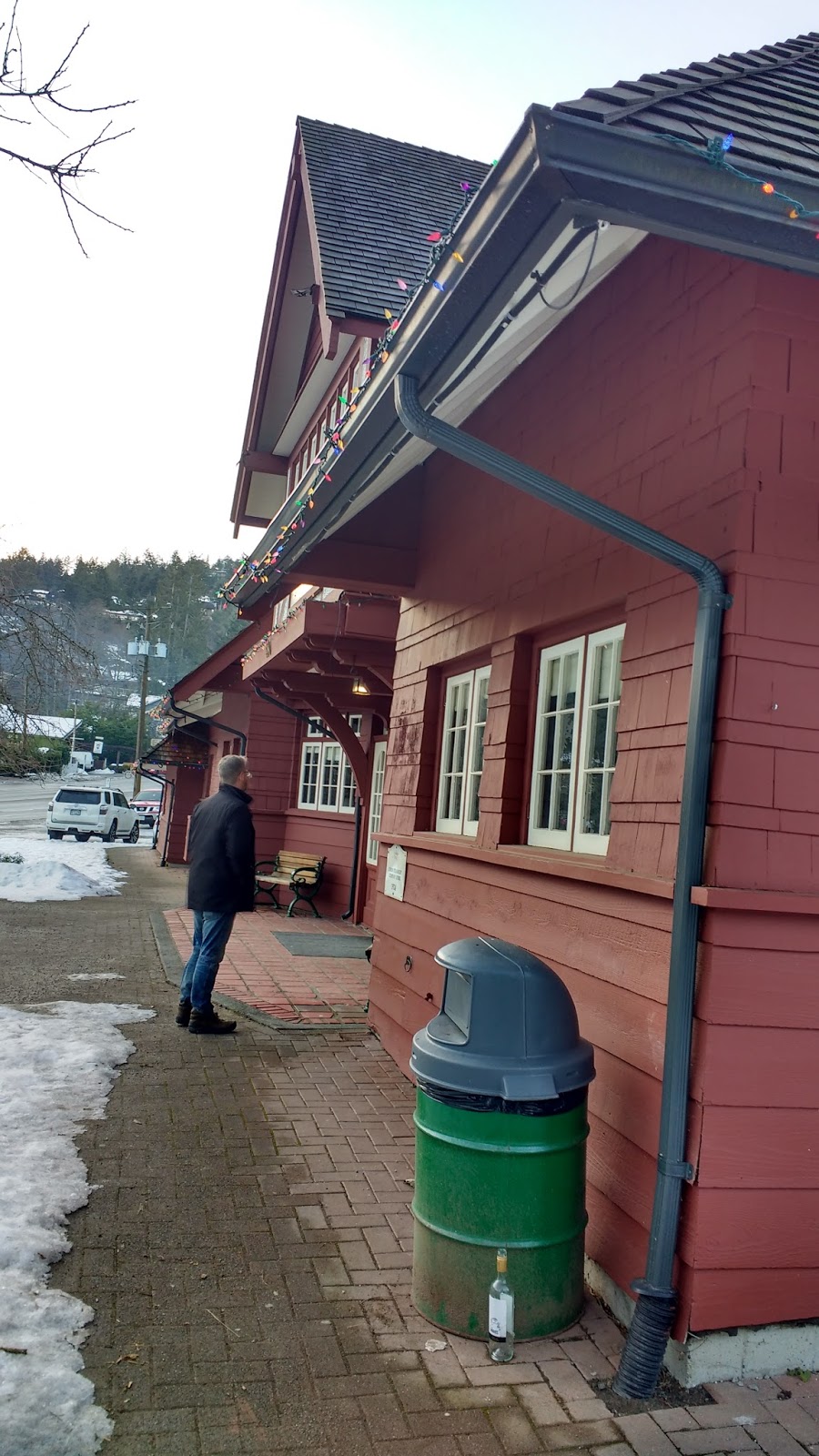
On the street-side of the square, we spied a rare Budweiser Fern in full bloom! This might have been the first time it had been seen in the wild!


(Since this first portion of the walk was so similar to the one I took to Collins Rd earlier in the month, I posted fewer photos and less geographical/historical info about this section-- limiting myself to the experience of the walk).
From Village Square, we headed down Miller Rd, past the Museum and the Police Station. The snow closest to the road was filthy and black, but the path was still bright white.

The sky was blue, but the air was cold, and I laughed at my strange collection of gloves, which I brought for warmth (ski gloves) plus use of my camera/phone (one partner-less finger-less knitted glove, necessitating a third knitted glove to "match").


I noticed some strange orange powder on the snow at the intersection. I had been seeing this stuff everywhere lately, and couldn't figure out what it was: some kind of animal vomit?? There seemed to be too much of it... Seriously, it really took me a long time. Let's see how long it takes you... ;)

Yeah, so there were a lot of trees and branches downed by the snow this year. lol. Someone had been around with a saw to get them off the pathways and roadways.
Next, we crossed the creek, which was quite high, but calm, and walked down to the entrance to Killarney Creek Trail, on the other side of Miller Rd.

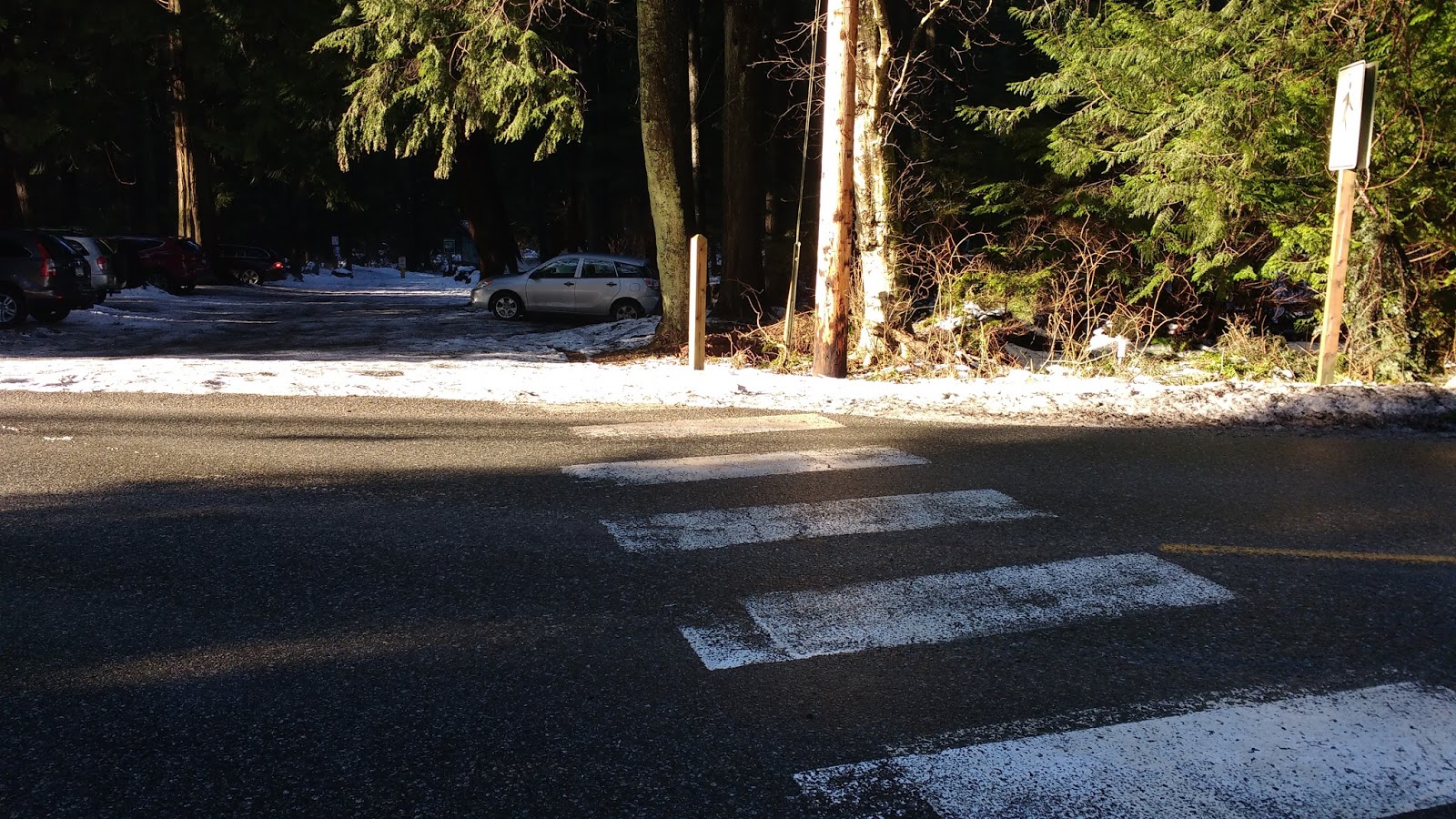
There was a lot of signage at the trailhead, which began right out of the parking lot.

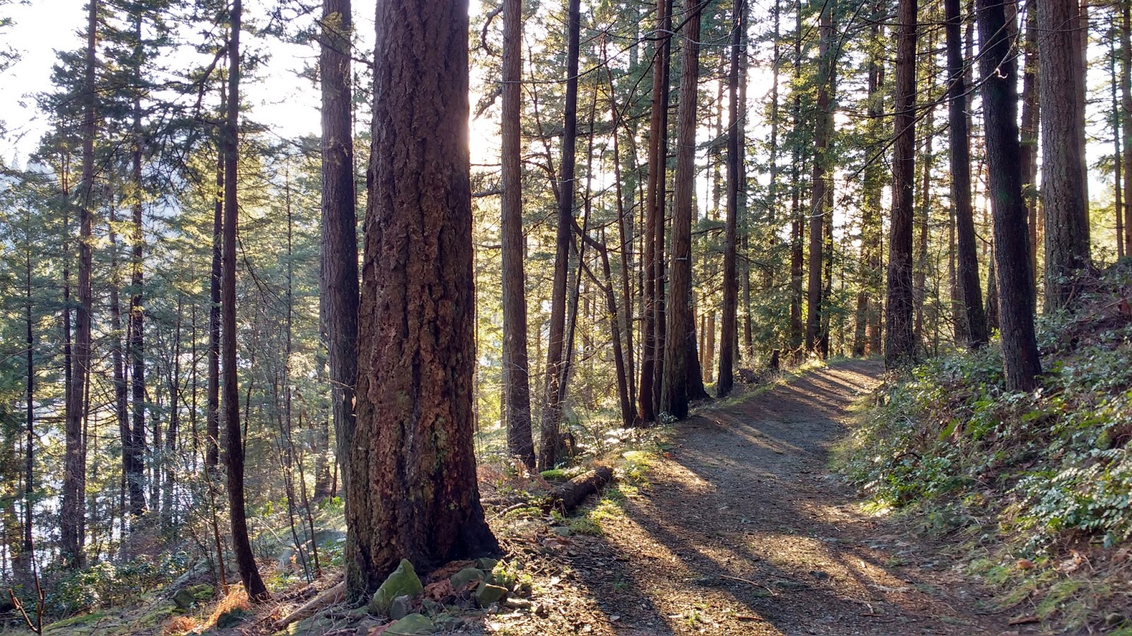
At the first junction, we turned right onto Collins Trail. I had originally thought that there was no signage at that junction, but later realized that it was on the left side of the trail, near the garbage cans (not shown in photo).

Again, it was a winter wonderland on that trail, and I really enjoyed the way the light played through the trees on this day. (I would get even more lovely light-strewn photos of this area on the way back.)

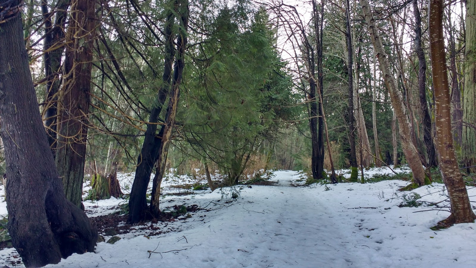
Soon enough, we were exiting the trail onto Collins Rd/Reed Rd, and we made our way over to the Little Red Church, back at the corner of Miller Rd.


Turning left, we soon faced the hill of Miller Rd, but the footpath to David Rd saved us from having to climb the hill. The entrance off Miller Rd was marked with a colorful fish windsock. Although it appeared that at some point one needed some kind of electronic key code to open the gate for a vehicle, when we passed, the keypad was smashed. In any case, the footpath was open and clear, to the left of the gate.


There was another route in to David Rd, a little farther along Miller. This route gave a nice view of Deep Bay. Actually, I had found this other route when looking at houses along this stretch of Miller Rd.


While walking along Miller Rd, if keep your eyes peeled, you will see a small dirt footpath leading off the side of the road. It is fairly short and direct, dropping down to David Rd, which at that point, was a dirt road.


While walking along this wooded section of David Rd, there were no houses, driveways, or footpaths that I could see, leading off the main road. It was a beautiful and very peaceful stretch. Much nicer than walking on the narrow shoulder of busy Miller Rd.

As David Rd turned to cement, another gate blocked cars from entering, but again, the footpath ran beside the gate. This gate had no technology on it at all --not even a chain to hold it closed-- so I was not sure why the other side had an electronic keypad entry system!

After the gate, we left the forest, and David Road stretched out in the sunshine before us. All along the length we could see peek-a-boo views of Deep Bay, over top of the houses perched on the shore below the road.


Now, I keep referring to "Deep Bay," but that nomenclature is technically out of date. Since 1980, the official name has been Mannion Bay.
The name "Deep Bay" became popularized when the Union Steamship Company (USSC) bought the hotel resort from Jack Cates in 1920. Although the the bay had been given various names before that, including "Hotel Bay," according to The Undercurrent, "the name Deep Cove had appeared on a British admiralty chart as early as 1868," making the moniker the longest standing.
Jack Cates had bought the 160-acre Lot 490 from Joseph Mannion, who had lived on it for ten years (1886-1905) before moving back to Vancouver. In fact, it was the Mannion family home which became the famous Bowen resort hotel during the steamship era.

(click on image to enlarge screenshot from bowentrails.ca slideshow)
Mannion opened Bowen Island's first brickyard, after 68 acres of "rare blue clay" was discovered in the area. The Mayor of Vancouver, David Oppenheimer, also opened a brickyard on Bowen, and apparently contracted his own brickyard for building the city's new Municipal Hall. Mannion's bricks were also used to build Vancouver buildings, as well as to build the Bowen General Store (now the Bowen Public Library).
The location where Mannion's ships would load their bricks later became known as "Sandy Beach," after the newly commissioned steamship Lady Alexandra dumped her ballast of sand there, upon her arrival from Scotland in 1924.
When the steamship era faded (ca. 1964), the USSC subdivided the property, and most of it became private residences, save Sandy Beach, which became public.
In 1979, a local movement rose to rename Deep Bay as "Mannion Bay." The government approved the change, although the name didn't catch on particularly well locally, and most maps (including present-day google maps and city maps) continued to show it as "Deep Bay."
In this stretch of David Rd, there were many driveways branching off of the road, but fortunately for us, no traffic-- especially when the snow had frozen to ice in several places along the hilly one-lane road.

I wouldn't have wanted to be driving along it and encounter another vehicle! I supposed that one of them would have to back up until they reached a driveway. I wouldn't want to deal with driving backward up that slippery incline. :p
We finally reached a section free of snow, and arrived at Ecclestone Rd. Imagine my delight! Well, Colin didn't have to imagine it, as I believe I may have squealed and jumped up and down like a schoolgirl. XD


We turned right down Ecclestone Rd. The water access was supposed to branch off fairly quickly to the left-- or perhaps straight ahead. The two maps I had seemed to disagree on how the roads turned in this area, but both showed a fork of some kind.

We were looking to turn left, as the road split. A street sign directed us with an arrow that "249 Robert Rd" was down the left fork. A stop sign faced the other direction.

While the intersection didn't look much like the one shown on google maps, it did somewhat resemble the one on bowentrails.ca, and we wanted to turn left either way, so I figured everything was copacetic.
I kept my eyes peeled for the water access trail, which bowentrails.ca told me was pretty much right at the intersection. But I didn't see anything clearly marked as a trail to the water. Or any trail, for that matter!
On googlemaps, the road went straight out to the left, but on bowentrails.ca the road did a curlicue back to the right and the trail went straight through the loop. So I kept looking for anything heading off the road to the right. A driveway branched off to the right, and it looked promising as a potential water access, but Colin was just enjoying the walk and had already gone on straight ahead to the end of the road, so I followed him.


Little yellow-headed birds darted across the road as we walked. At the end of the road was a fence in front of a house. The number on it read 249. (You can see the fence on the left, in the photo below.)

"Don't try to touch him!" she yelled at us from her gate at the other end of her driveway, while the dog snapped and snarled at my heels as if I were some kind of Felon Degenerate.
"What are you looking for?" she yelled, looking at us suspiciously, as I tried to gently fend off the tiny dog's nips with my boots, without hurting it.
When we explained, her demeanor changed, and she amiably pointed out the closest public water access trail. It was to the left of the fence at the end of the road-- pretty much right behind us.
"It really doesn't look like much," she warned, but she assured us that it was indeed a public trail to a "rickety staircase" that led to the water.
"The other one is about two houses back," she explained. "There's a little white house. Go down the driveway, to find the trail. He's put his canoe stuff there, but don't let that throw you, because it is public access."
Armed with this new info, we turned around and found the first trail pretty much exactly where she had described. It left the road right by a yellow guy wire, to the left of the gate at the end of the road.

The narrow trail was pretty easy to follow, but it REALLY felt like we were just walking around in someone's yard. I was glad for the neighbor's reassurances that we were on a public trail.


Neither looked particularly "rickety." One looked like it went more directly to someone's house, so we chose the other staircase (the one closest to us). It looked like it ran between the houses.

The staircase ended partway down the hill, and emptied onto a rough path.

We followed it, and soon we were faced with another staircase, but this one behind a closed gate. Peering through the gate, I was certain that this staircase led directly to the front door of the adjacent house. But it seemed like the trail might continue to the left of the gate.

Taking a few steps down that very steep and rough incline, it really looked like there was a flat, clear path down below, leading off to the left, towards the water. I decided to risk it. Colin followed me down.

The flat path exited onto a lovely grassy area. There didn't seem to be any easy way to get to the water from there, but the views were spectacular.

I tried to take a pano of the amazing view, but for some reason, it kept erasing the middle of the shot!

(click to enlarge)
So here's a "fake pano" I made by stitching some photos together. On the left, the snowy North Shore mountains rose from the sea. To the far right, past where my "fake pano" reached, I was sure I was looking at UBC and Point Grey, just past Passage Island in the foreground.


On the far right side of the second "pano" above, you can see there was a small sign. I didn't quite understand it, but it seemed to be part of a movement to "revitalize" Mannion Bay, by obtaining a 30-year Licence of Occupation, cleaning up the bay, and limiting illegal moorage.

Past the sign, a lovely bench overlooked the ocean. In the water, a cormorant floated past on a log, and a trio of harlequin ducks puttered by on their own steam (that photo was too potato quality to bother posting at all).


On the far left of the clearing, there was a tiny "inlet" of ocean, and a steep hill on the other side.

Looking up at the house on that hill, we noticed a deer checking us out intently.


It was only then that I noticed the bottom of the stairs leading from that house. They sure looked "rickety"! I realized that we were probably supposed to have gone down the other staircase. Although I was not sure I would have dared standing on the bottom of that staircase!

After one last look at the nice views, we turned back and retraced our steps back up the path to the staircase we had descended.


I kept looking for a path leading over to the other staircase, but I didn't see one.

Back up at the grassy clearing at the top of the staircases, we didn't retrace our steps back to Ecclestone Rd, but rather, continued forward on the path, and exited onto Edwards Rd.


I turned around when we reached Edwards Rd and looked back. The footpath was marked with a red address sign, "1160." There was nothing to show that it led to the public water access.

This excursion spurred a discussion about the public easement trails on private lands throughout Bowen. So many were unmarked. Although many had never been marked, some locals were known to remove public trail signs (even though that was not legal!), to discourage people from walking on the right-of-ways on their lands. Other residents would try to discourage hikers by putting up "private property" signs next to the trails, which were technically true (the surrounding lands were private), although the public was legally allowed to walk on the trail itself.
We had a public trail crossing our own land, and it was not marked, even though I had seen on our land title that the public did indeed have a right-of-way easement to walk there (but not to bring motorized vehicles onto it). However, we mused, for the sake of argument, if we were to put a little archway over the trail, and a fence on each side, especially if marked with "private property" signs -- all of which would be within our rights (as long as we did not actually "block" the trail itself), it would sure intimidate people into thinking the trail itself was also "private." Not that we would ever do that ourselves, but we had seen similar "tricks" in various configurations throughout the island.
Now, don't get me wrong: I don't mean to imply that all Boweners hate hikers! Many, like us, have no problem with public walkers, and are happy to increase the trail system. Others are perhaps just not aware or not certain about where, if, or how the easement laws apply to their lands. We seriously had nearly three dozen pdf files of Legal Notations and Interests on our Land Title. All written in confusing "legal-ese." Although I took the time and made the effort, I'm pretty sure that not many people are willing or able to wade through all that. Perhaps some owners would have bothered when they first bought the property, but then not refreshed their memories in the decades since then.
There is certainly at least some landowner confusion around these easements, as the lines on the map have grown fuzzy or forgotten, over many years of residence. For example, an employee at the municipal hall recently told me about going to check on the state of a public access trail and being yelled at by the landowner, who adamantly claimed that the area and trail was all private. "No, sorry, I don't think so," smiled the city worker, map in hand. "This is a municipal trail!"
We talked as we continued along Edward Rd, and less than 50m later, turned right down David Rd.

Speaking of hidden signs, even the street sign at the intersection of Edward and David Rds was buried in a bush, and barely visible from David Rd.

Bowentrails.ca had showed another public water access at the end of David Rd, so we walked the short distance to the end to try to find it.

We passed this cute inukshuk (inunnguaq), but it did not lead us to the trail nor any fish. ;)

At the end of the road, there was a house, but no clear path leading to the water. I scoured their driveway with my eyes, but saw nothing even remotely promising. With no random neighbors around outside to tell us where to go, we finally gave up and turned around to walk back up David Rd towards "The Village" (aka Snug Cove).


Colin was ready to call it a day, but approaching the corner of David Rd and Ecclestone Rd, I begged him to go back and find the first water access trail that we had not found earlier. He finally acquiesced.

We turned down Ecclestone and took the same left at the fork, and I kept repeating the description she gave us: "...about two houses back... little white house... down the driveway... canoe stuff on the trail..."

We went down the driveway I had seen before... the one that looked "hopeful" as a water access.


It curled around to the right to reveal... Yay! A little white house!!!

Just past where the house's fence ended, there appeared to be a grassy/mossy trail heading towards the water. But then after a little bit, it seemed to veer right and onto the house's patio.


So we tried a second trail that led over to the left. There were some kind of dilapidated structures on that trail. Although there were no actual canoes. But could these be the "canoe stuff" that the lady was talking about? We couldn't tell.


The structures completely blocked the trail, as we got near the water. So we just turned back.

It was only then that I finally understood the discrepancy on the maps I had been using: bowentrails.ca was showing THIS DRIVEWAY as the "road." Whereas, google maps was showing the actual Ecclestone Road, but not this driveway at all.

(click image to enlarge screenshot of bowentrails.ca)

(click image to enlarge screenshot of google maps)
We retraced our steps back to the intersection of Eccclestone Rd and David Rd, and turned right onto David Rd to head back to Snug Cove.
In this direction, it had an "end of public road" sign, which might discourage some people from entering, but then, the road leading to the parking lot for Artisan Square and BIM had the same sign, and that certainly *didn't* mean that the public was not meant to drive and shop in there! It simply signaled city workers (like the snow ploughs) about who was responsible for maintenance of the road.


As we approached the gate at the end of the pavement form this direction, the driveway at the right could easily be confused with the road. Stay to the left to get to the gate.


We walked down Miller Rd until we got to the Little Red Church at the corner of Miller Rd and Reed Rd. There, we turned right to head back to Collins Trail, which was located near where Reed Rd turned and became Collins Rd, about 150m past the church.


Near that corner, we kept our eyes peeled on the forest on our left. The trail signs were easy enough to see, set back a few metres into the trees. If you have trouble spotting the signage, look for the yellow guy wire on the right side of the road: it's about equal to the trail. If you get to the "Collins Rd" street sign at the corner, you've gone too far.

The sun filtered through the trees in gorgeous rays, and I tried to capture it with my camera.


Too soon, we were back at the junction with Killarney Lake Trail. We turned left to see a very chipper yellow lab, festooned with jungle bells.


We walked through the parking lot and turned right back onto Miller Rd.


We walked down over the bridge to the crosswalk, where we re-entered Killarney Park, on the other side of the road.


We plunged into the trees, taking Alder Grove Trail on the left, rather than the trail that ran on the shoulder of Miller Rd.


At the junction with Cedar Trail, we encountered more seasonal festivity: a group of walkers in Santa hats.


Alder Grove Trail led past the lagoon on the left, and through the trees to the Memorial Garden.

Although we didn't stop in at the gardens that day, we did a very similar walk the next day, and stopped in to take in the great view of Deep Bay from atop the grassy knoll.


From the knoll, we could see the Causeway down below, and decided to walk down there and take a look.

On the way out of the Memorial Gardens, we noticed that someone had added a Christmas decoration to the plaques on the archway. There were also shiny Christmas balls on the nearby rhododendron.


We continued along Alder Grove Trail towards Cardena Dr, passing the Seaside (Cottage Number) One. Sorry folks, I think I managed to capture an equally poor shot of it as I did last time.


Turning left onto Cardena Dr, we headed towards the Lagoon.


The ice on the Lagoon was slowly melting.


The water was rushing through the fish ladders on the Causeway, and ducks approached us, hoping that we had food. Sorry ducks!


We walked up Cardena Dr, past the old Boulevard Cabin, back to "Government Rd" (aka Bowen Island Trunk Rd). Sorry folks, no better photo of THAT today either! ;p

To our left along Cardena Dr was the peninsula between Deep Bay and Snug Cove. Right around the time of the aforementioned 1964 subdivision, one of the lots on the peninsula became Camp Bowen, a camp with workshops for the blind and visually impaired. (Yeah, it took me *this long* to figure out that "Pedstrians May Be Blind" sign along Cardena Rd.)
Here's a map from mapbowenhistory, showing the area in the late 1970s. You can see the CNIB retreat, carved out on the bottom side of Deep Bay. The "undeveloped" lands on the South-West ends of the two bays later became part of Crippen Park.

When the Canadian Institute for the Blind (CNIB) sold the facilities in 2010, a group of former campers formed a society, which eventually found a place under the umbrella of the Canadian Council for the Blind, and took over the programming, continuing to offer workshops for the visually impaired. The Bowen Island Lodge now also hosts weddings, corporate retreats, health and wellness retreats, and workshops of all types.
Colin wanted to stop by the public library on the way home. The library was small but fairly well-stocked, with work tables, and even a magazine reading nook complete with comfy wing-back chairs. However, on this day, the library was closed. Ah, rural life. ;)

We turned right on Government Rd, and made our way up back towards our starting point in Village Square. If we had turned left instead, we would have been at the ferry.


Back up at the corner of Government and Miller Rds, the bright primary colors of the art in Stacy Beamer's yard stood out against the bright white of the snow.

The clouds above the North Shore mountains rose up like a dragon, ready to breathe out its fire.


As Colin made supper, I enjoyed the twinkling of our holiday lights. Mmmmmm sparkly.....

After supper, we opened our presents. Rory was eagerly awaiting his promised meat stick.


To round out the night, we polished up the pie that Kitty made us. Thanks Kitty!! :D

Sorry there was such a big gap between the last post and this one. I had spent over a week researching and writing it, then my laptop crashed and somehow I lost a full week of work. So then I had to find all those research links agagin and rewrite it all. :p
ReplyDelete