
I awoke to a beautiful poem by Lisa Shatzky, posted on Bowen Island Everything Else. It spoke to my experiences of the last six months. Fitting to see it on my birthday. :) My first birthday gift of the day! Here's an excerpt:
"you are given a picture
for better or worse
of what something should look like
and if you’re not careful
you will spend your years
trying to make yourself or others or life
fit into the picture
[...]
believing if you do all the right things
repent and atone and sit with a begging bowl
and ring a small bell
then the good picture will arrive
like a reward
at the end of the road.
Herein is the problem:
you could live and die trying
and vying
to make a picture fit
or you could let it all go -
keep no pictures
[...]
and just be here... "
Noticing that the snow had all melted (birthday gift #2!), I decided to try to walk the elusive trail along Dorman Rd. You know, the one I kept peering at and wondering about all winter. Then, in the spirit of finding new "hidden" trails, I tried again for the trail leading from Pebbly Beach in Mannion (Deep) Bay to David Rd in Miller's Landing, which I had seen on the Schedule E map and failed to find before. After a few false starts, this time I had success at both! :)
My route is outlined in pink dots on the map below. It was about 5 km in total, mostly flat with a few short steep trail sections.

(click map to enlarge)
I knew that the Dorman Rd trail must end somewhere near the entrance to Crippen Park on Dorman Rd. But I had a lot of trouble finding the trail. Finally, I noticed a "Trail" sign, propped up on the side of a shed, inside the fence of the ECOfluid Wastewater Treatment Plant. It had obviously been removed from its original location.


I decided to just walk on what appeared to be a trail, just on the left side of the fenced-in plant. Two steps in, it seemed like I might be at a trail junction. I looked to my left, and could see the Crippen Park entrance sign directly ahead. I THINK the "official" trail ran from the sign, to the right of a large tree-ball, to where I was standing. But it seemed much easier and clearer to enter from the wastewater plant's driveway.


I continued along the fence of the wastewater plant to its other side. It was really unclear whether there was an overgrown trail a few metres away from the fence, or whether one was meant to just follow the fence. After a few false starts, I ended up doing the latter.


At the other end, I exited onto what was a very clearly established path. To my left, I could see glimpses of the Crippen Park field and picnic area, between the trees. I also spied an interesting little "ladder" nailed into a tree... although it was unclear what its purpose would be...?


Then I reached a clearing with several green metal hatches. I realized that the path to my left led directly to the boardwalk along he beach!


Straight ahead, past the grey metal hatch, led to another junction: straight ahead to the beach, and right up to Dorman Point.

So where was the trail that ran parallel to Dorman Rd?? I was confused. Was I just seeing the trail to Dorman Point, this whole time????
Then, my other trail experiences kicked in. I realized there was a creek to my right, flowing past the green hatches. On other trails, the creek WAS the trail... I decided to brave it and find out.

After a dozen metres, the creek evaporated, and became an obvious trail! Success!!


The trail cut across the steep slope. Above me to my right, I could sometimes see Dorman Rd. Below, to my left, I could sometimes see the other trail leading to Dorman Point.
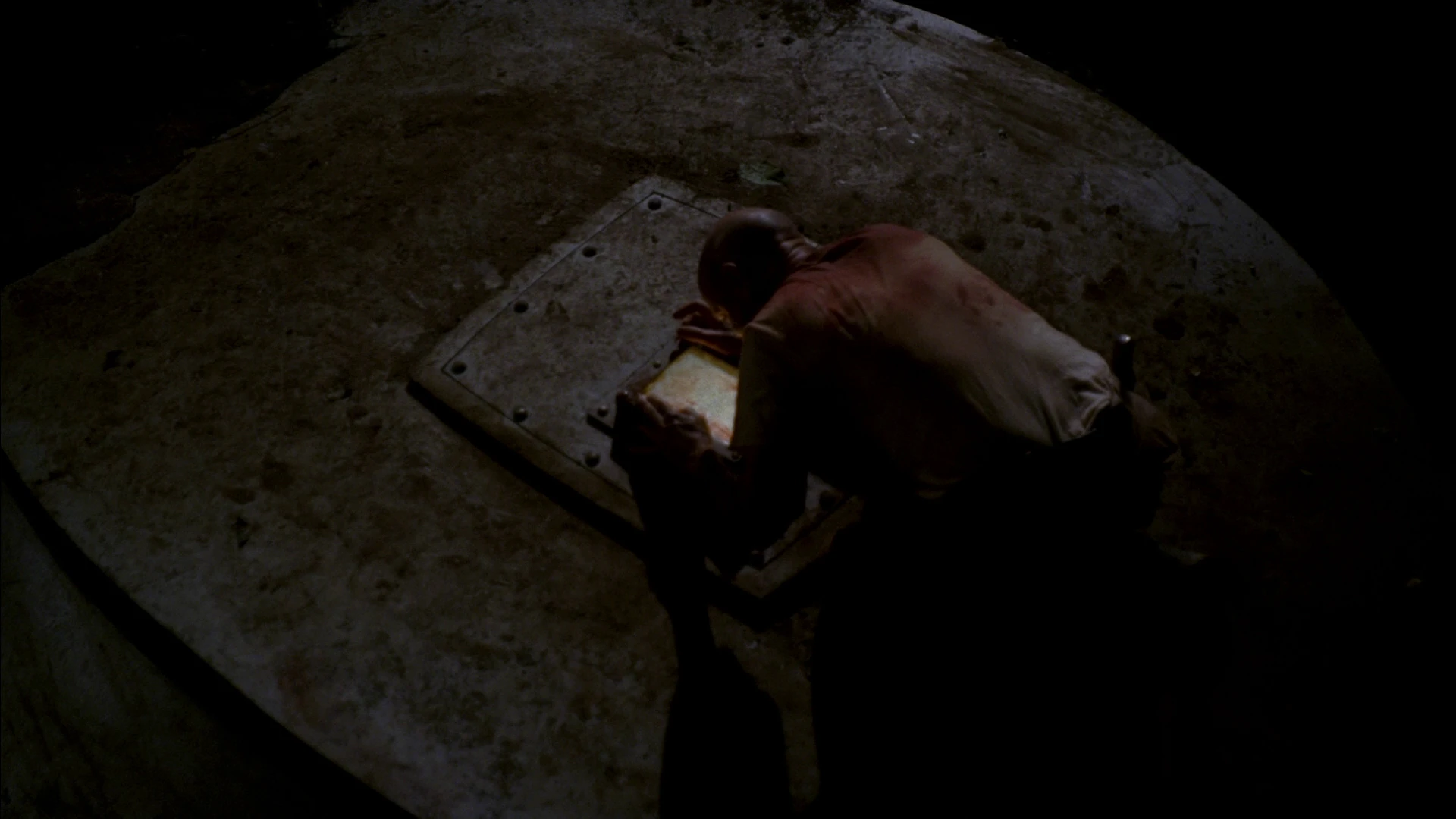
Then: a strange sight! A very "scared" box of some sort hiding in the bush... closer inspection revealed it was a stove!

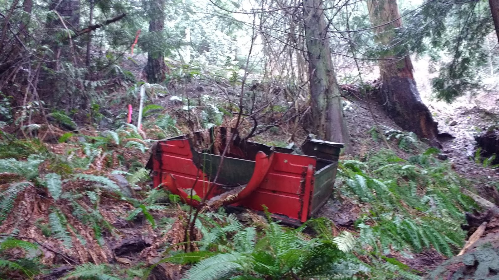
Why was a stove there??? I don't know! But then another discovery gave some possible insight... some kind of cart, and lots of debris strewn around. Looking up, I realized we were close to a curve in Dorman Rd. Perhaps whoever was pulling this cart didn't negotiate the turn correctly, and lost their load over the side?
A little later, the path headed uphill and joined Dorman Rd.


I exited onto the road, took some photos for posterity, but realized that I didn't really want to walk back along the road. So I turned around and headed back in on the trail.


It was then that I noticed that there seemed to be a side trail, leading off to the right, just at the end of the first downhill stretch. I followed it... big mistake. Huge.
It led to a golf ball, a beer can, and lots of deer poop. It was a lacklustre lookout at best. If the "trail" continued past this point, it was overgrown and obstructed by fallen trees. Maybe it was only a deer trail after all.

I felt something on my neck, and brushed at it absentmindedly. After deciding that this trail led nowhere of note, I returned to the main trail and continued onward. A dragon, semi-submerged in the undergrowth, watched me pass....

Back past the debris field... to where I could see the Dorman Point trail, below to my right... and back to the clearing with the green metal hatches.


From this angle, it was quite clear that the creek into the clearing was a path. From this angle, it appeared to flow directly into the path that led down to the beach and picnic area.

But instead of going that way, I decided to turn right at the clearing, go past the grey metal hatch, and visit the beach from another access that I had never walked before.
I went straight past the junction with the Dorman Point Trail. A trail sign pointed me in that direction, but I ignored it, to get to the beach.


Exiting onto the beach, I noticed the ferry was loading. I had a flashback to a First Nations Drum workshop I had taught a few years back, when we collected our drumsticks along this beach.

Across the water was the USSC Marina building, and to the left, I could see the cabins which remained from the island's "steamboat era" in the first half of the 20th century. I described both of these at length in a previous blog.


I walked along the beach a while, admiring clam shells and remnants of crabs, before turning back. It was then I realized that the path I had taken to get here was not very easy to see, from the beach. Look for this really long tree trunk, sitting at about 90 degrees to the water (see last log back in photo below). The path passes by its far end.


Once on the path, it was easy to follow back to the clearing with the hatches. I retraced my steps back to the wastewater plant, and along the fence to Dorman Rd.


The trail by the fence was a little difficult to see, until you are right up at the fence. It runs between the fence and this large maple trunk. It seemed possible that there was once a trail on the right side of the maple, but it was very overgrown at the time I was there, so I stuck to the fence.


Exiting onto Dorman Rd, I turned right, and walked along the road past Grafton Rd. I paused and took a look at the tools that were out for display at Bowen Island Tool Rental.

I walked along the trail beside Miller Rd until I turned at the mailboxes, onto Cedar Trail.

I was met with a strange sight: many neon pink spray-painted tags on the trees!


There had been a lot of buzz on the island about the creation of "Parking Lot 3." I wondered whether this was the beginning of that Joni Mitchell song...
Turns out it was. The Bowen Island Municipality (BIM) had identified trees to be removed, for the installation of the lot, which would allow commuters to park for free for up to 12 hours.
Part of the argument for the creation of the new lot was the desire to reduce overall car traffic on the ferry. Councillor Maureen Nicholson was quoted as expressing this argument.
Another part of the argument was that an allocated parking area was recently lost in the Cove, due to the construction of the new Cove Commons complex, which was designed to be used for programs related to the Public Library, the Arts Council, and other community events. It would also serve as a new home for the MedShed (medical equipment lending program), which lends free medical equipment for periods up to 3 months.

(click image to enlarge, or go to www.bimbc.ca/parking)
Plans for a new ferry marshaling system outlined more possible changes to the Cove, laid out in a multi-stage process. The establishment of the proposed "temporary" Lot 3 parking lot sat at #7 on the list, but there was no mention of its later removal.

(click image to enlarge, or go to https://bowenisland.civicweb.net/document/45730/Item%2010.6-%20140722-Ferry%20Marshaling%20and%20Parking%20Con.pdf?handle=71A61CD8DC924755B3F3E8FC3A9FBD4D)
All Municipal Councillors involved stressed "the temporary nature of the lot." I am not sure if that was meant to appease island residents who were appalled at the destruction of what for decades had been commonly considered an integral part of Crippen Park.
Although the trails of Crippen Park did pass seamlessly through Lot 3, I was surprised to learn that Lot 3 was actually Municipally-owned "Community Lands," and not actually designated as part of the 600-acre park. This means that it was already zoned for "mixed-use applications including residential,
commercial and short-term parking." If you look closely on my screenshot of the Schedule E map at the start of this blog, you can actually see it is a different color than the rest of the park.
Despite this designation, many island residents spoke out against the development of the parking lot. I too, was saddened to see the trees marked for death.
According to the BIM update on the situation, dated Jan 25, 2017, "Approximately 25 - 30 trees would need to be removed for ease of entering, exiting and parking. [...] Larger cedar trees
could remain making the parking areas into smaller pod areas." The idea was a create a more natural-looking "forest lot" similar to the one at the Crippen Park entrance off Dorman Rd. A map was offered.

(click image to enlarge or go to bowenisland.civicweb.net/document/121237/Bob%20Robinson%20re%20Snug%20Cove%20Parking%20Report,%20dated%20Ja.pdf?handle=E7C10833339C434884B79CB75E3F361F)
A couple of weeks later, I walked that same route again, and all those trees had been bulldozed. A large gravel parking lot sat in their place. With its barren crushed rock face and cement barriers, it sure didn't feel very "forest-y." :(


I hoped that Cedar Trail still existed, on the other side of the lot. It did. Notice the difference before and after.


I turned left at the next junction, still bemoaning the fate of the trees.


On my left were many little paths and creeks that cut back up to Miller Rd.


I mused that much of this area could be removed, if Bowen went ahead with the relocation of the fire hall and Emergency Operations Centre. A large sign sat in the foreground on Miller Rd, announcing the potential future of this area. The introduction of the proposal was slated to be presented at the Municipal Council Meeting on this very day (UPDATE: read pertinent developments on this project here).

Despite appearances, this nature-filled area was still Lot 3, and not officially Crippen Park.
At the junction of Cedar Trail and Alder Grove Trail, I kept left, continuing on towards the Fish Ladders, Bridal Falls, and Miller Rd.


At the junction for Bridal Falls, I stayed left again, heading towards Miller Rd. I had visited the falls and the fish ladders on previous days. On this day, I had a mission: finding the trail from Pebbly Beach in Mannion (Deep) Bay to Miller's Landing.

After capturing a potato image of another feathered forest friend, I turned right onto Miller, and admired the skunk cabbage just emerging from the mucky banks of Terminal Creek.


I turned right onto Melmore, just in front of the St Gerard's Mission Catholic church, and walked to Pebbly Beach. (I'll have to cobble together some previous photos of this portion from a few other blog entries. I didn't take any photos this time, because I wasn't sure I'd even find the trail, and besides, I was sure that I had already walked/blogged this portion previously. Apparently, not so much...)

First, I followed Melmore Rd around to Senator Rd.


There, I turned left, and made my way to the intersection with Senator Place.


From there I could see the beach access, and started hunting around for a trail that led Northwards.
I found many tiny side-trails, and many wrong trails, leading to people's houses. The little trail network off Senator Place was amazing!! But didn't lead anywhere of use to me. I'm adding my (mis-)adventures here, simply because the trails were so cool! What gifts! :D
I popped my head through a tiny opening in the bushes off the side of Senator Rd, and was surprised to see a very established set of trails leading to the left, and a little later, branching off over a little footbridge to the right, which crossed the creek and headed off even farther to the right.

I first took the trail to my left, ignoring the bridge. A set of brick stairs led up into a stand of bamboo.

Past a red gate to someone's yard on the left, the path continued onward to the right, so I followed.

A loose set of concrete block stairs led up the steep bank. But they emptied again into someone's yard. I poked my head through the wall of bamboo to see if there was a trail there that led back to the road, but it appeared that to get to the road, one would have to walk directly over the person's lawn. That didn't look like a "path" at all. I turned back.


As I descended the concrete stairs, I scoped out the opposite bank of the creek. It rose like a monolith. No Northward-heading trails to be seen there!


Back at the junction of the brick stairs and the little footbridge, I took the footbridge.

It led along the opposite bank of the creek, then split, with a stone staircase leading up to the left, and a grassy path leading straight ahead. The grassy path then split again. Since I was fairly sure that the grassy path simply led to a nearby house, I popped up it a few metres, just to be sure. Both grassy paths led to houses/yards, and seemingly not beyond.


I went back and tried the staircase. It was quite overgrown, but seemed to be heading in the right direction. I picked my way through the brambles. At the top, a path appeared to run between a property marker post and a fence. I was sure I had hit the jackpot: this was typical of where many right-of-way easement paths ran. I followed it along the fence.


Alas! The path was a dead end. Another set of stone stairs teased me, beyond the fence grate. Having exhausted the paths in this network, I headed back towards the beach itself.

I decided that the trail could be ON the beach, below the tide line. I walked down tot he beach and was delighted to see it was low tide! Unlike my last visit here. The beach signage made it clear that this was the public entrance to the beach.


I went up and looked through the open gate. Apparently, the unlocked gate to the left of the beach signage was indeed the entrance to the path I was seeking! At my first cursory glance, I had assumed the gate just led to a private parking spot. But no! It continued onward, beside the fence, all along the shoreline. :D I did a little happy dance.


The trail led through some wilted grasses, then emerged on the other side, uneven and rocky.


After that, it looked like not much more than a deer trail. I started to second-guess myself. Did I want to crawl through this overgrown brush? Maybe I should just hop the fence and walk on the beach??

But I could see where the trail I was on merged with the trail from the beach, and decided I was close enough to just finish up from where I was. At the junction, I could see the way to the beach, and a path leading up the hill. I was ecstatic. I had found the trail!!!!


At the "V" of the junction (where I was standing, to take the above photo), was a second trail leading down to the water. I could see a very large rock bluff, and decided to check it out, before heading uphill. It led to a gorgeous view of the entirety of Mannion (Deep) Bay.

(click photo to enlarge pano)

My hair tickled against my neck, I figured because of the light breeze. I popped it up under my toque to head up the hill. This portion of the trail was steep and rough.


I reached a junction and paused. The Schedule E map didn't show any forks in this trail! Looking at my compass, I decided to go right.


I followed the easily visible trail up to David Rd!! :D Just as I emerged onto David Rd, a jogger and a bicyclist passed by, travelling in opposite directions. I made a note of my surroundings: there was a big pile of large rocks, and a teal-colored water pipe. Without noting those, I might not locate the trail whilst travelling along David Rd.


This trail was much more overgrown. It also led up to David Rd, just a little farther along.


Rejoining the other fork below, I continued on, down towards the beach. What was steep coming up was equally so heading down. From this angle, the trail looked even more precarious and dilapidated than I remembered. Some sections looked rotted out and ready to collapse.


After ducking under the last windswept tree, I was at the last turn to the beach.


For those of you who would rather access the trail from the beach, here is a photo looking back at the entrance. The nearly invisible trail is close to the end of the fence, visible on the left side of the photo. On the right of the photo, you can also see the rock outcropping I stood on to take my selfie, above.

Once on the beach, I took my time, scouring the shore for treasures.

I found a huge crab, and fired a text off to Nihan to joke that I had gotten a "seafood feast" for my birthday after all! (Last year, Colin took me to Joe Fortes for my birthday, where I ate an entire seafood platter for two on my own, which in turn, was inspired by THIS similar platter that I ate in France).

Exiting the beach at the publicized entrance, I headed up Senator Place and turned left onto Senator Rd.


However, being so pleased with myself over the many trails and surprises that I had found today, I was not paying attention, and missed the turn onto Melmore, instead walking down Senator Rd to its end. Oops! At the end was a dog shelter and a lovely farmland property, with tons of Canada geese grazing on it.


Laughing at myself, I turned around and got onto Melmore Rd. I decided to head back via the Lagoon, since I was going to meet Colin at Doc Morgan's Pub for my birthday dinner.

Along Melmore, I passed the Lodge at the Old Dorm. This time, I got a nice photo of it. This was actually literally an old "dorm" of sorts, for housing staff of the Union Steamship Company Resort, during the "Steamship Era." Each room carries the name of a boat in the USSC fleet. As I mentioned previously, this area had been the location of the USSC vegetable and animal farms.


Where the road curved, near the speed limit sign, I took a left onto the walking path past the Lagoon. I wrote about the history of the Lagoon here.


On the other side of the Causeway, I walked past the yellow posts to Cardena Dr, and finally got a decent photo of the white Seaside (Cabin Number) One.


As I got close to Bowen Island Trunk Rd (a.k.a "Government St"), the ferry was unloading, as was the BC Transit bus. I cut through the Public Library grounds and crossed the road during a gap in traffic.


I beat Colin, since he was unloading on that ferry. As he sat down, I rubbed absentmindedly at my neck again. "My neck has been ticklish all afternoon," I commented. "It better not be a tick!" I joked. Colin leaned in to get a good look. "It's a tick." I declared.
"WHAT?!?!"
I ran to the washroom to look in the mirror. Trying not to panic, I took one last bush at it with my fingernail. It fell off. Fortunately, it had been wandering around on my neck and had not latched on securely yet. I supposed that all my random pawing at it on the trail had impeded it from settling in for a good chomp. Thinking back, I knew EXACTLY when it had landed on me: exploring that Dorman Rd side-trail with all the deer poop. That's when I first felt something on my neck.
Somehow, I got the tick onto a paper towel, and carried it out of the washroom with me.

Back at the table, still shaking, I wondered what to do with it. When the waiter arrived to take our order, I asked whether they had a ziploc bag or small plastic container that I could have. He brought me a to-go cup meant for salsa. "Will this do?" He asked, mildly confused.
After securing the tick in the container, I ran back to the washroom to do a full body check. Not finding any more ticks on me, I decided it was time to get drunk. And finally order my fish and chips.

For dessert, I got the Warm Sticky Toffee Pudding. It was almost enough to make me forget the tick incident... Almost...

I sighed a breath of relief. But, the day wasn't over yet... My dog Rory had left a present for me in the living room... 💩💩 I was definitely seeing a downwards trend in these birthday gifts... >.<

"Time to do what needs to be done..." I declare...

No comments:
Post a Comment