Ever since we got back from Nanoose Bay, our dog Rory had been diligently checking the neighbors' door on our daily walks. He had stayed there with our neighbor, while Colin and I had visited Jan on Vancouver Island. On most days, I let him sit there a while, before telling him, "nobody there!" and urging him onward. On this day, however, his diligence paid off, and our neighbor exited her door with a look of surprise, to see Rory sitting there patiently waiting for her.
So we walked the dogs around the neighborhood together, as she was dog-sitting another neighbor's two dogs on this occasion. We both complained about how the snow and ice had been limiting our walking. She was a fan of big long walks, too. We saw a trio of huge raptors --eagles or turkey vultures-- it was hard to tell at that altitude.
At the end of our walk, Rory headed back to her door instead of ours, and one of the other dogs followed me through my gate. "I think we've switched dogs!" I called, with a laugh. We each ushered the correct dog to the correct house, and parted ways.
To be honest, I had been getting really frustrated by the weather recently. On this day, it was -6°C and icy. Betty reported -10°C in Coquitlam. Both temperatures were bizarrely low for the GVRD. (Karen reported -24°C in Keremeos, in the interior of the province. At least we didn't have THAT!)
But even at -6°C, it was difficult to walk anywhere on Bowen: I was afraid of getting stuck, afraid of falling, and afraid of driving to the other side of the island, where it was slightly warmer and I knew the trails were clearer, because our road was again not ploughed and had crusted over with ice. (To be fair, Bowen had been doing a decent job in keeping the roads ploughed; there was just so much snow, that it was hard to keep up!)
I had to work on letting go of more levels of "needing to achieve/accomplish." Now that my adrenals were starting to recover, some part of me was nagging that I should be "doing" more... Then ragging on me that what I actually WAS doing was "not enough" and since I couldn't "go big, to go home." Lol. It was an old program, trying to tell me to go back to my "over-doing-it" lifestyle.
I had to pause, and remember that my discomfort often meant I was on the threshold of change. And get my inner Picard loaded up. ;)
I also had to remember my successful burnout recovery program that I did after my MA... Going to the gym with a 15 min time limit felt ridiculous, but it's exactly what I needed to recover. Pushing myself more would not lead to a faster recovery, but instead it would just lead back to collapse.
It was a little reminder of the difference between "I am capable of doing x" (especially when that includes a "barely" and a crash after), and "I choose to do x." As a wise mentor once told me: just because you CAN, doesn't always mean that you SHOULD.
(You can tell I was having a philosophically-inclined day...)
So maybe the day's walk would have to be shorter, slower, and mostly on roads. It was still a walk, and as it turns out, a fairly satisfying one at that!
I chose to go find the public Labyrinth near Rivendell, and on the way, stop at Artisan Eats in Artisan Square. I'd use many of the public "right of way" cut-throughs on Cates Hill, including a new one I had never before taken, but hoped to locate (spoiler: I did!).
It was a route of approx 4 - 4.5km in total, rising up about 120m in altitude from Snug Cove to the top of Cates Hill, near Rivendell. In this blog entry, I speak of a few trails that I did not walk on, and so I marked those with orange dots on the map below, for your reference. My actual route is marked in purple.

(click on map to enlarge)

Like the day before, the walkway of Village Square was thankfully clear of ice and snow.

I turned left (West) onto Grafton Rd, and quickly encountered one of the wooden "birds" that marked the various trails up to Artisan Square.


Local comic artist Ron Woodall captured the reality quite well: "Through a brilliant strategic planning achievement, half of Bowen's visitor attractions were built at the top of a coronary inducing trail. The reason for this is a local secret." ;p


Normally, one could read the signage there, beside the statue called the Spirit of the Flame, carved by Shane Tweten and Simon Daniel James. On this day, the map was covered pretty well with snow.

The trail to which Ron's comic was referring was off to the left, before the statue, as shown in the photo below. It was indeed steep, and I decided against trying it on a day where the ground was packed with ice. What Ron's comic didn't mention was that there were several other, easier trails that led up to the same place.

So I took the trail to the right, along the rock face beside Grafton Rd (in the photo below, it is marked off with orange pylons).
Just past the rock face, the trail went up a short set of wooden stairs to a picnic area.


At the other end of the picnic area, there was a colorful birdhouse on a pole, which also hosted a trail sign. There, I had the choice to turn left onto Orchard road, or cross Orchard road and continue along a pedestrian footpath parallel to Grafton Rd.

Here is the view to the footpath. There was a white sign saying "pedestrians use path provided." However, it was quite icy on that day, and I didn't fancy navigating the rough footpath.

Instead, I turned left onto Orchard Rd.

The road was very short, not much more than a long driveway, really. There were brightly colored birdhouses on the trees along the way, to show that this was still a "bird walk" trail to Artisan Square.


Although there were many bird houses, there were not many actual song birds in this stretch. However, there were sure a lot of ravens flying about. :)
At the top of the road, I entered into a little cul-de-sac of housing. That development was relatively new (in the last ~10 years); however, it was obviously sorely needed, as rentals were hard to come by on Bowen. The rental turnover in these six townhouses was practically non-existent.

One could walk on the concrete through to the end of the houses, and then take a right hand turn up a long set of wooden stairs. Or, one could do as I did, and simply do nearly a hairpin right turn right away, into a rough lane blocked with a yellow pole.

Up ahead on the left of this lane were more colorful birdhouses, and a white sign, stating "Trail to Artisan Square."

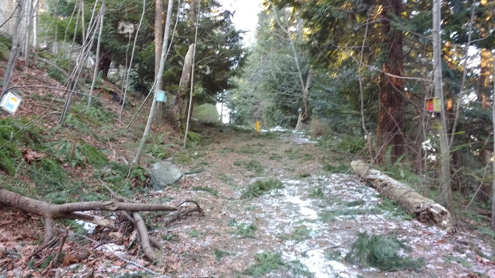
There were actually quite a few downed branches on this short portion of the trail, leftover from the recent windstorms. However, it was not difficult to navigate.

The top of the trail was marked with another yellow pole. That was the exit onto the street.
This street was Prometheus Place, and if one had taken the stairs on the other side of the townhouses, one would end up here in any case.

More lovely bird houses beckoned me upwards, towards Artisan Square.

Artisan Square itself looked somewhat like a winter wonderland. The views of the North Shore mountains, peeking over the slope of Mt. Collins in the foreground, were spectacular.


I took the left-hand fork in the road, onto what was actually a back lane, as a shortcut up to Artisan Eats. Giant icicles clung to the rock faces on my left. Air bubbles rose underneath the icy fingers, as water dripped its way down the rock.

At Artisan Eats, my face clung to the glass, trying to select a perfect tasty treat. I ended up with a butter croissant. I just can't resist me a good butter croissant!


Satiated, I went back down the icicle-encrusted lane back to Prometheus Pl.

I took a left and proceeded down Prometheus Pl. The entrance was marked with a blue sign, "Bowen Island Municipal Hall."


Back down the hill I went, past the yellow post where I had exited onto this road before, and all the way until the Municipal Hall, aka. the BIM building.


On the right side of the BIM building, a set of wooden stairs led upwards, and a gravel path led straight ahead, to the rear side of the building. The stairs would have taken me directly up to Village Dr. However, on this day, I took the gravel path.

Behind the BIM, I got another great view of the North Shore mountains. The trail continued directly onward, down a long set of stairs. Yes, you guessed it-- the ones leading down to the townhouses.


The stairs looked slippery, but were actually not as slippery as I expected: the dry powdery snow created a layer of grip.

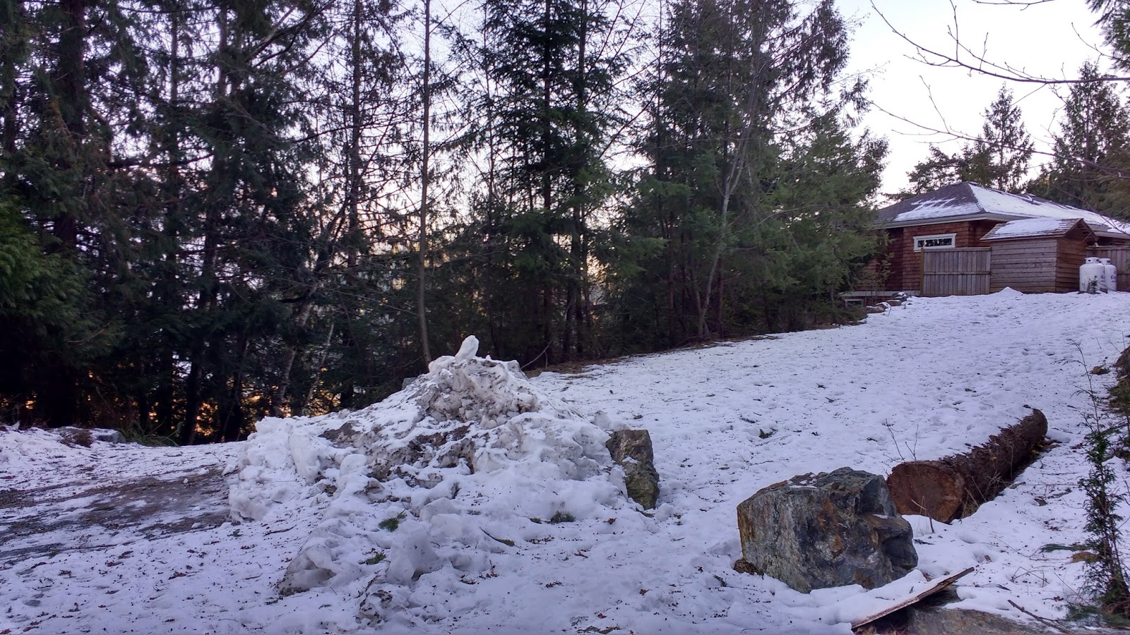
At the bottom of the stairs, I could have continued straight ahead, which would have taken me down the very steep trail referenced in the comic above. However, I turned right, because yes, there was yet another trail in that direction! This one led to the back of a house with two large propane tanks sitting by the fence. Did it seem like walking into someone's yard? Yes, it did! However, I think that by now, dear reader, you will be getting used to recognizing these public right-of-way easements. ;)

The last time I came through this trail, the owner was discussing taking down the branches that had broken in the snow and were obstructing the path, and considering removing the whole bush. I could see on this trip that the guy totally did have to cut back a bunch of his bushes!

I stepped tentatively along this very icy section of Captain Cates Walk, since on my last time through here, I had fallen in this stretch.


The bottom of the stairs were a little difficult to locate at first, since the snow plough had covered up the wooden rounds at the bottom. Well, I made it ALMOST to the stairs when, sure enough, my feet went out from under me. This time, I managed to escape without any road rash. ;p (Why wasn't I wearing my yaktrax, you ask? Very good question!)

Annoyed, but unhurt, I climbed the stairs up to Village Dr.

After the first little section, the stairs were ok to climb. A few large branches had fallen onto the stairs, but were easily pushed to the side.

I just loved the little blue playhouse with the Tibetan prayer flags and the draw-bridge entrance, which graced this path, about half way up the stairs.

The top of the stairs exited onto Village Dr, right across from Harbour View Pl.


I turned right onto Village Dr, and headed up the hill. At the first hairpin turn, one could head through the stone pillars and there was another path to Artisan Square-- the one that ended in the long staircase to BIM. But I kept to the road and headed up towards the sun.


At the next intersection (Sea View Pl), I turned right, in hopes of finding a new right-of-way easement trail up to Rivendell. As I proceeded up Sea View Pl, a very loud and plaintive cat mewled out in the silence. It took me a while to locate it: it was at the doorstep of a nearby house, hoping to be let in. It started following me up the road, but was frightened back by a passing car.


I continued up along Sea View Pl. I had never been up this road before.

I was shocked by the amazing views that started to appear before me.

I turned around on the hill to see this glorious vista...

... and realized that most of the houses along here would have this view.

As I reached the cul-de-sac, a sanding truck passed me, then turned around in the cul-de-sac, and headed back down Sea View Pl... spewing sand everywhere on the road and my legs as well. Despite getting showered with sand, I was happy to see the truck, as the road was slippery to walk on. It was hard to imagine anyone actually driving up here on these steep roads.


It was unclear whether this part of the road was actually still Sea View Pl, or whether it was simply an "emergency access," as indicated by a sign. This part of the road was not shown on google maps, although it could be seen on satellite view. (Many of Bowen's more recent roads were not visible on google maps; it needed updating.)
I suspected that the right-of-way easement that I was looking for was along this stretch. I was right: a set of stairs led up the rock face to the right, right about where I expected to find it. However, just to be sure that it was the correct path, I walked all the way down to the end of the road.

It ended in another little cul-de-sac, furnished with a patio set. What a nice little enclave this would be in the summer, I mused, imagining the neighbors sitting around chatting while their children played together nearby.

Satisfied that the staircase was most likely the trail I was looking for, I headed back to it. I double checked with my GPS on google maps' satellite view, and it certainly seemed like the right place. I headed up.


I exited onto Elrond's Court.

Turning around, the sun was nearly blinding, but I managed to get one usable photo of the staircase entrance from the top. Again, it would be difficult to know that this was a right-of-way easement, because it was right beside the driveway to the house (# 923).

Along Elrond's Court, an open lot offered an amazing panoramic view, which I struggled to capture with my pano function of my cell phone camera.

I continued uphill on Elrond's Court. It suddenly made a hairpin turn to the left, and at the corner, a sweeping vista took my breath away and put a delighted grin onto my face.


Down below, I could see sailboats bobbing around in Deep Bay.

I climbed even higher, and at the intersection with Rivendell Dr, turned around to see the striking vista yet again. I realized how much more impressive this walk would have been, if I had walked in the opposite direction.

At the intersection with Rivendell Dr, I didn't actually continue straight onward to Rivendell iteself, but rather, I turned left to head down to the Labyrinth. If I had instead turned right onto Rivendell Dr, there was another foot path that would lead back to Artisan Square, down a looooooong set of stairs.

The Labyrinth was located in a big park about half way down Rivendell Dr. I had walked past these fields many times before, not realizing they were a park, or that they contained a Labyrinth! Before this, the only Labyrinth I knew about on the island was at Xenia, which I had walked many times in the past, when visiting the island to lead workshops. I made a mental note to put Xenia on my list of upcoming walks.

I couldn't find out much about the Rivendell Labyrinth, except that it was designed by Bruce Haggerstone, and completed on June 3, 2007. It was said to be an eleven-circuit Chatres Labyrinth. I was really excited to see it and walk it.
A Labyrinth is not the same as a maze, because whereas a maze can have many choices of path, and many "wrong turns" or "dead ends," a Labyrinth has only one single path to walk. It is a metaphor for the journey of our life. My favorite way to walk a Labyrinth is to clear and ground myself, then walk in with palms up, open to receiving insights about "anything I need to know." On the way out, I do either palms down or palms together, saying or breathing "thank you" with every step, for any insights or messages I received.
The Labyrinth had been clearly visible when I zoomed in on Google maps' satellite view of the area, so I knew basically where to look for it.


I crossed the field, and made a guess as to where the Labyrinth would be. Some footprints, frozen into the snow, helped direct me as well.

I could see that people had been trying to walk the Labyrinth, despite it being covered in snow.

I tried to dig down through the snow to see what the base was, but couldn't dig through the ice. I figured that if it had been made of big rocks, like the Labyrinth at Xenia, I would have seen big bumps where the rocks were, underneath the snow. However, since the surface was flat, my guess was cement (I was totally wrong, about this btw-- I would have to come back later to confirm what the surface actually looked like. If you can't wait, and want a sneak peak, Richard Bott has some great photos of it on his flickr account).

A trail ran behind the labyrinth, parallel to Rivendell Rd. I walked southSalong it a little ways, trying to determine whether it was public of private.


I passed a sign that said Cates Hill Park, which faced the trail, not the park. Well, that made it look like the trail was public. Why would that be there, unless it was a public access??

However, the trail ended in what looked like a house's yard. It seemed that I could cut through to Berry Rd, along the left, but an open gate across that entrance made it look like a private driveway entrance. I thought of the gate at David Rd, and looked for a footpath beside the gate. I couldn't see any.


Pondering the seeming contradiction of the sign and the gate, I wondered: maybe the road down from Rivendell was public, and this end was private?? It was all very unclear.
I turned around, and cut back through the field to Rivendell Rd, and walked down past the intersection of Village Dr and Berry Rd, to check the trail from the other side.


From Berry Rd, it looked like a private driveway. There was an address and a family name posted, and no trail running on the outside of the gate. So I simply went back to the intersection, and proceeded down Village Dr.

The bright blue sky and the white snow darkened all of my photos, as I rounded the corner back to Seaview Pl.

But the mountains rose out above the houses like monoliths.

I passed the stone pillars of the hairpin turn, and followed the zig-zagging Village Drive past the cut-through at Harbour View Pl, all the way back down to Village Square in Snug Cove.


As I arrived back home, I saw same neighbor from that morning, driving off. I made myself a lovely fresh veggie and chickpea sandwich for lunch (the secret to chickpeas on sandwiches is to push them into the guacamole, so they don't roll away while you eat).

But my dog Rory was groaning and moaning like there was something wrong. I let him out, and he ran straight to the neighbor's door. "She's not there-- I just saw her leave!" I tried to explain to him, in vain.
I blogged until Colin got home, missing both nap time and cheese time, so it was not surprising that I had a mini-melt down after supper. Just can't skip those crucial naps, no matter how much I "accomplish" by doing so. Fortunately, Colin was over his cold enough to lend a sympathetic ear, and a shoulder to cry on.
Despite that, the evening ended on a funny "up" note: We had previously put a melon outside our front door because it was starting to turn, and we thought, "it will be OK out there in sub zero temperatures until organic disposal day"... Which was tomorrow morning... But on our evening dog walk, I got ready to grab the melon, and I noticed that it was gone. Where was the melon?????????? 😂😂😂😂😂😂😂
We guessed maybe raccoons??? Even though we've never seen any or even evidence of any in our neighborhood. What other animal could get through our deer fencing, and abscond with a whole melon without leaving a trace???
We spent way too long trying to figure it out. It had been pretty windy, but if there was enough wind to move a melon, and a rotting one at that, then surely it would have knocked over other stuff on our porch...
And we didn't get enough new snow to cover a whole melon, so if it rolled, we would still be able to see it as a white "lump"...
The neighbor's dog might have had access to our yard that morning, but dogs make a mess... There would be evidence... They don't pick up a whole melon in one piece... And I saw the dog a minute after he left our yard, and he didn't have it at that point... (at least, I didn't think so... was I bamboozled again?!)
Omg the melon mystery... 😂😂😂
I imagined some squirrels using an elaborate pulley system... To bring it to the deer, who were gathered in the nearby forest around a table with napkins, knives, and forks...
Humans could do it, but who?? And, more importantly, WHY??? Who would want a rotted melon??
I could imagine a kindly neighbor seeing it, and thinking, "I'll put that in organics bin," except that the melon was around the side of the house, so not something the neighbors would see unless they were already at our door, and as far as I know, no one had visited us in that time. Perhaps most importantly, we each had our own bins (ours was quite small, "kitchen sized," hence putting the melon outside of it, instead of in it), and there was no organics pickup in between when we put it out and its disappearance, so they'd just have it sitting and rotting at their house instead of ours?? 😂😂😂
The 2016 "mystery of the missing garbage bin" was solved by telling our plight to one neighbor, and letting the neighbor network do its thing. Solved within one day. Maybe it was time for similar action for the 2017 "mystery of the missing melon." Lol. Not that we would want it back, but I was actually really curious to see if it ended up somewhere weird...
I did try the same strategy for the melon, and while we all got a good laugh, sadly, it was never found.
A friend on the island recently recounted a story to me, where she watched a raccoon haul a full-size green (organics) bin over a rooftop, so my money is back on racoons!
ReplyDelete